

Lesson
Arabia and Iraq: Geographic Passport

Students are introduced to the physical geography of Iraq and the Arabian Peninsula. Using maps and an article as reference, they consider important features of the region. Then they focus specifically on the water resources of this mostly-desert region. Finally, they do their own research on the Arabian camel and present their findings to the group.
Product in action
Preview scene 1

- Describe the physical features and natural resources of Iraq and the Arabian Peninsula.
- Explain the population patterns of Arabia and Iraq.
- Identify the location of fresh water in the region.
-
Describe the physical features and natural resources of Iraq and the Arabian Peninsula.
-
Explain the population patterns of Arabia and Iraq.
-
Identify the location of fresh water in the region.
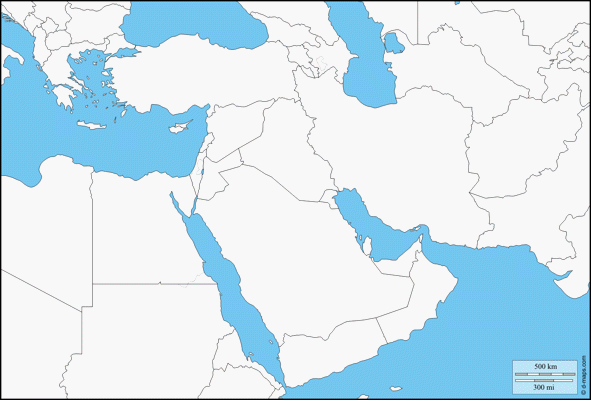
What part of the world does the central part of this map show? In a word or short phrase, share your guess with your classmates.
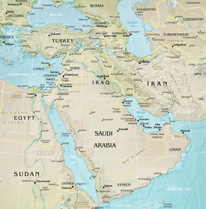
-
Iraq
-
Yemen
-
Oman
-
Qatar
-
Bahrain
-
Kuwait
-
Saudi Arabia
-
United Arab Emirates
If you were a trader from Arabia, what body of water would you cross to reach Iran?
Continue the experience
Teach the complete lesson with Exploros.
See how staged content, student participation, and teacher guidance work together across the full learning experience.
Southwest Asia and North Africa
More lessons in this unit
 Arabia and Iraq: Geographic Passport
 Israel and Its Neighbors: History and Its Influence
 North Africa: Government and Economy
 Religion and Its Influence: The Origins of the Abrahamic Religions
 North Africa: Society and Culture
 Israel and Its Neighbors: Geographic Passport
 North Africa: Society and Culture
 Arabia and Iraq: Government and Economy
 Religion and Its Influence: The Origins of the Abrahamic Religions
 Turkey to Afghanistan: Government and Economy
 Arabia and Iraq: History and Its Influence
 Turkey to Afghanistan: History and Its Influence
 Israel and Its Neighbors: Government and Economy
 North Africa: Geographic Passport
 Arabia and Iraq: Society and Culture
 North Africa: History and Its Influence
 Israel and Its Neighbors: Geographic Passport
 Arabia and Iraq: Society and Culture
 North Africa: History and Its Influence
 Turkey to Afghanistan: Geographic Passport
 Israel and Its Neighbors: Society and Culture
 Israel and Its Neighbors: Government and Economy
 Religion and Its Influence: The Origins of Islam
 Southwest Asia and North Africa: Unit Review
 Religion and Its Influence: The Origins of Islam
 Turkey to Afghanistan: Government and Economy
 Turkey to Afghanistan: Society and Culture
 North Africa and the Middle East: Unit Review
 Israel and Its Neighbors: History and Its Influence
 North Africa: Geographic Passport
 Arabia and Iraq: Government and Economy
 Turkey to Afghanistan: History and Its Influence
 North Africa: Government and Economy
 Turkey to Afghanistan: Society and Culture
 Arabia and Iraq: History and Its Influence
 Israel and Its Neighbors: Society and Culture
 Turkey to Afghanistan: Geographic Passport