Europe: Geographic Passport


World Cultures Europe Europe: Geographic Passport
Students are introduced to the physical geography of Europe. They create a map to explore and compare aspects of Europe. Next, they consider the connection between the landforms and the human geography of the region. Finally, they create a postcard for one country.

This learning experience is designed for device-enabled classrooms. The teacher guides the lesson, and students use embedded resources, social media skills, and critical thinking skills to actively participate. To get access to a free version of the complete lesson, sign up for an exploros account.

1:1 Devices
Teacher Pack

The Pack contains associated resources for the learning experience, typically in the form of articles and videos. There is a teacher Pack (with only teacher information) and a student Pack (which contains only student information). As a teacher, you can toggle between both to see everything.

Here are the teacher pack items for Europe: Geographic Passport:

Preview - Scene 1
Exploros Learnign Experience Scene Navigation


Engage


Overview

In this experience, students are introduced to the physical geography of Europe. They use maps to explore and compare aspects of Europe. Next, they consider the connection between the landforms and the human geography of the region. Finally, they create a postcard for one country.

This experience contains a lot of content. You may choose to teach it over two sessions in order to spend adequate time on the various elements of European geography.

The regions of Europe used throughout this experience are divided as follows:

Western Europe

  • France
  • Germany
  • Belgium
  • Netherlands
  • Luxembourg
  • Switzerland
  • Austria

Northern Europe

  • Iceland
  • Finland
  • Norway
  • Sweden
  • Denmark

Southern Europe

  • Spain
  • Portugal
  • Greece
  • Crete
  • Italy
  • Sicily
  • Sardinia
  • Cyprus
  • Malta
  • Monaco
  • San Marino
  • Andorra
  • Vatican City

Eastern Europe

  • Hungary
  • Czech Republic
  • Slovakia
  • Latvia
  • Estonia
  • Lithuania
  • Poland
  • Moldova
  • Belarus
  • Ukraine
  • Romania
  • Albania
  • Bulgaria
  • Slovenia
  • Croatia
  • Bosnia
  • Serbia
  • Kosovo
  • Macedonia
  • Montenegro

Objectives:

  • Describe the physical features of Europe.
  • Identify the four physical regions of Europe.
  • Trace patterns of settlement throughout Europe, particularly as it relates to physical geography.


The continent of Europe is divided into about fifty different countries. Close your eyes and think—can you name ten of them? In this experience, you will get to know the regions of Europe, focusing on the major water and landforms and the connection between these geographical features and humans.

Objectives:
  • Describe the physical features of Europe.
  • Identify the four physical regions of Europe.
  • Trace patterns of settlement throughout Europe, particularly as it relates to physical geography.


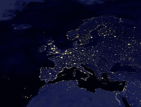
night view of the lights of Europe

Satellite View of Europe at Night


Take a look at some interesting facts about Europe, by scrolling through Europe Facts.


Add an interesting fact that you know about Europe. If you can’t think of one, then post a question about Europe.


Discuss student responses. If students do not know a lot of facts, focus on framing questions about geography that can help drive this experience.


When everyone is ready to continue, unlock the next scene.

End of Preview
The Complete List of Learning Experiences in Europe Unit.
Would you like to preview the rest of this learning experience, and get access to the entire functioning World Cultures MS course for your classroom? Sign up using your school email address below.
Back to top