The Roman Empire: Geography


Social Studies Middle School The Roman Empire: Geography
Students identify cultural groups and historical developments in widespread parts of the Roman Empire. Through online research, they investigate the traits and histories of specific barbarian cultures and explain how those peoples affected history. Then, they state and explain their preferences for Roman city versus provincial life.

This learning experience is designed for device-enabled classrooms. The teacher guides the lesson, and students use embedded resources, social media skills, and critical thinking skills to actively participate. To get access to a free version of the complete lesson, sign up for an exploros account.

1:1 Devices
Teacher Pack

The Pack contains associated resources for the learning experience, typically in the form of articles and videos. There is a teacher Pack (with only teacher information) and a student Pack (which contains only student information). As a teacher, you can toggle between both to see everything.

Here are the teacher pack items for The Roman Empire: Geography:

Preview - Scene 1
Exploros Learnign Experience Scene Navigation


Engage


Overview

In this experience, students identify cultural groups and historical developments in widespread parts of the Roman Empire. Through online research, they investigate the traits and histories of specific barbarian cultures and explain how those peoples affected history. Then, they state and explain their preferences for Roman city versus provincial life.

Objectives

  • Identify the location of and political and geographic reasons for growth of Roman territories and expansion of the empire.
  • Describe the geographic borders at the height of the Roman Empire.


Over its existence, the Roman Empire grew and then shrank. In this experience, you’ll learn where it grew and when. You’ll learn what its provinces were like and the geographical factors behind the empire’s growth and decline.

Objectives
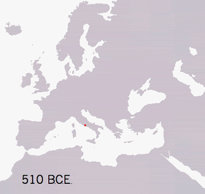
  • Identify the location of and political and geographic reasons for growth of Roman territories and expansion of the empire.
  • Describe the geographic borders at the height of the Roman Empire. 


Silhouette of a map of Europe

Look at the map and find the red dot. What does the red dot represent?

Post your answer

Explain that the dot is the city of Rome.


Now add animation to the map by going to Roman Republic Empire. You’ll see the red area expand, be joined by different colors, and then go through more changes. Watch the entire sequence of changes from -510 (510 B.C.E.) to +530 (530 C.E.).


What process do you think this animation shows?


The animation shows the growth and decline of the Roman Republic and Empire.


When everyone is ready to continue, unlock the next scene.

End of Preview
The Complete List of Learning Experiences in Ancient Rome Unit.
Would you like to preview the rest of this learning experience, and get access to the entire functioning Ancient World History MS course for your classroom? Sign up using your school email address below.
Back to top