
Have you ever wondered how geographers learn about the world? They use different tools to study where people live, the land, and how everything on Earth connects. These tools help us understand our world better.
Let’s take a look at some of the most important tools geographers use.
Maps
Maps are pictures of places on Earth. They help us see where things are located. There are many types of maps:
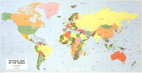
- Political Maps show borders between cities, states, and countries.
- Physical Maps show natural features like mountains, rivers, and lakes.
- Climate Maps show weather patterns in different areas.
- Population Maps show how many people live in an area.
- Cultural Maps show things like languages, religions, and traditions.
- Historical Maps show what the world looked like at different times in the past.
Maps usually have helpful tools like a compass rose to show direction, a legend (or key) to explain symbols, and a scale to show distances.
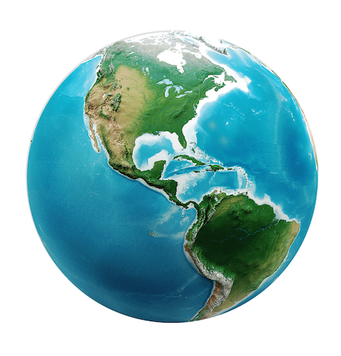
Globes
Globes are round models of Earth. They are useful because they show the shape and size of continents and oceans more accurately than flat maps. They help geographers understand how the Earth is divided into hemispheres and how the continents are arranged.
Coordinate Grids
Geographers use grids made of latitude and longitude to find exact locations on maps. These invisible lines help us know where a place is in the world.
- Latitude lines go sideways and measure how far north or south a place is from the Equator.
-
Longitude lines go up and down and measure how far east or west a place is from the Prime Meridian.
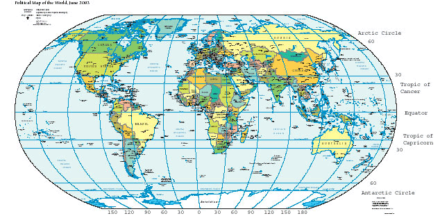
World Map with Latitude and Longitude Lines When you put both together, you get a coordinate that shows the absolute location of a place.
GPS (Global Positioning System)
GPS is a tool made up of satellites in space. These satellites send signals to Earth so we can find exact locations. GPS is used in cars, phones, and by scientists to study different parts of the world. It can even tell you how to get from one place to another.
Satellite Images
Satellites take pictures of Earth from space. These images help geographers see big weather systems like hurricanes, track changes in the environment, or map land and water. They give us a view of Earth that we can’t get from the ground.
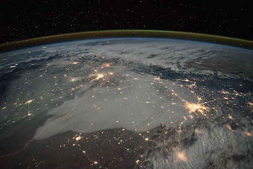
A nighttime satellite view of Northern India, showing bright city lights that reveal patterns of human settlement. Data and Charts
Geographers also use data, like charts and graphs, to understand information about people, places, and the environment. These tools help them ask and answer questions about what is happening in a place and why.
Why Are These Tools Important?
All of these tools help geographers study the world from different points of view. They help us solve problems, make maps, learn about weather, and even understand where to build homes and roads. Geography tools help us see the big picture—and all the little details, too!